


antique oarsman's map of the river thames, english, cartography, published 1912
- View other items in:
- antique furniture
- other furniture


london fine limited
Enquire about this antique
London Fine Limited has 2155 antiques for sale.
click here to see them all

Our Stock # 18.9531
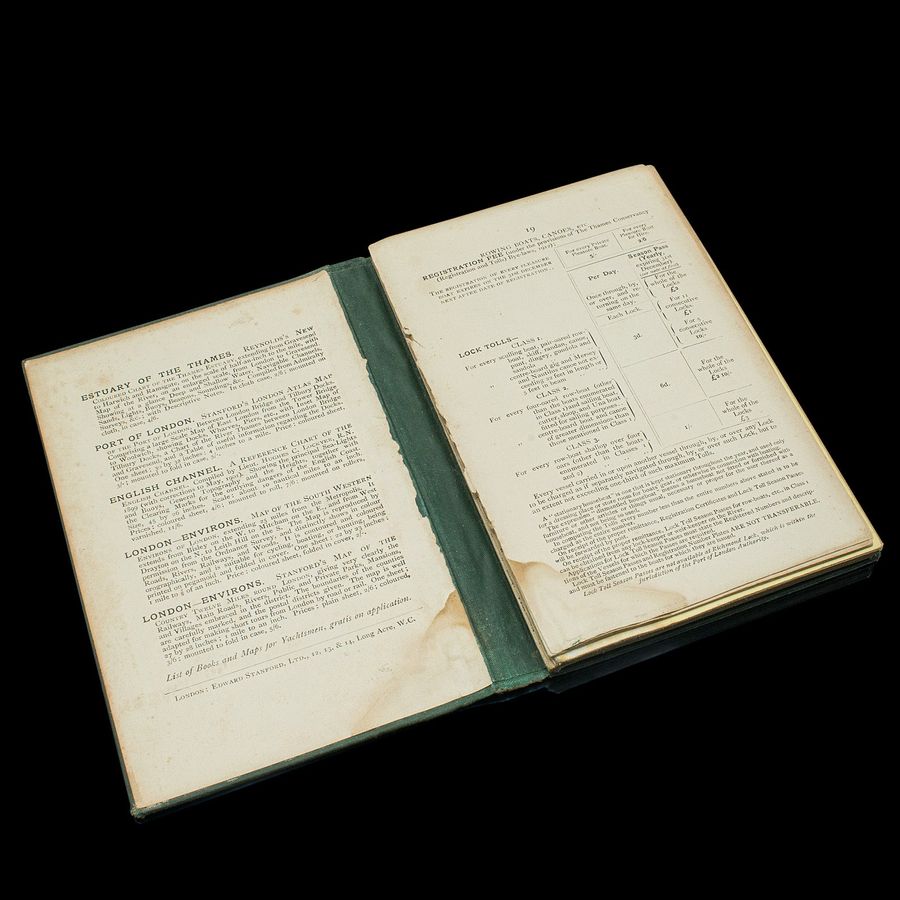
This is an antique copy of The Oarsman's and Angler's Map of the River Thames - New Edition. An English, bound map book, published in English by Edward Stanford, London, this new edition published in 1912.
Delightfully illustrated map charting the River Thames from its source in Kemble, Gloucestershire to London Bridge at a scale of one inch to a mile. Printed in colour and with a reference key that shows locks, weirs and railways et al. This new edition was published by Edward Stanford Limited of Long Acre, London.
- Displays a time worn appearance, the initial pages present, but loose
- The fold out map in very good antique condition commensurate with age
- Bound in a green canvas over board, the titling in gilt finish
- Across 25 pages spanning over 9 feet, the Thames map unfolds to a length of 2.83m (111.5'')
- Along the map, the notes add riparian detail of boathouses and inns
This is a fascinating antique copy of The Oarsman's and Angler's Map of the River Thames. The fold-out map at a length of over 9 feet is astonishing and a treat to read from. Delivered ready to enjoy.
Dimensions:
Max Width: 11cm (4.25'')
Max Depth: 1.5cm (.5'')
Max Height: 16.5cm (6.5'')
Map Unfolded: 283cm (111.5'')
Buy it now direct from the dealer here:
Antique Oarsman's Map of the River Thames, English, Cartography, Published 1912
Antiques.co.uk Ref: YWJ8WDD4M
Please note that this price may NOT include delivery charges which the seller may charge extra for.
London Fine Limited
London Fine Limited run by Clive Donwham. Fine antiques sourced in England and sold worldwide ............ About Us: We are a team passionate about antiques and customer service. With trade and private clients worldwide we offer a complete sourcing, restoration and delivery network. From order to delivery our focus is on customer service ............ WEB: www.londonfine.co.uk ............ TEL: +44 207 1833 511 ............ EMAIL: sales@londonfine.co.uk
Contact details
LONDON FINE LTD
The Antique Village
Hele
Exeter
Devon
EX54PW
UNITED KINGDOM
T: 0207 1833 511
E: sales@londonfine.co.uk
W: www.londonfine.co.uk
Other antiques available from london fine limited
-
![Large, Vintage Pew, English, Solid Teak, Bench, Modernist, 20th Century]() £1195.00
£1195.00large, vintage pew, english, solid teak, bench, modernist... Read more
-
![8 Antique Chippendale Revival Chairs, English, Mahogany, Dining Seat, Victorian]() £2950.00
£2950.008 antique chippendale revival chairs, english, mahogany, ... Read more
-
![Pair, Antique Sherry Decanters, English, Glass, Spirit, Liquor Flask, Edwardian]() £875.00
£875.00pair, antique sherry decanters, english, glass, spirit, l... Read more
-
![Pair Of Vintage Ginger Jars, Chinese, Hand Painted, Ceramic, Spice Pot, Art Deco]() £795.00
£795.00pair of vintage ginger jars, chinese, hand painted, ceram... Read more


