Atlases are a collections of maps, typically of specific geographical regions on Earth.
arthur hook, bristol, united kingdom
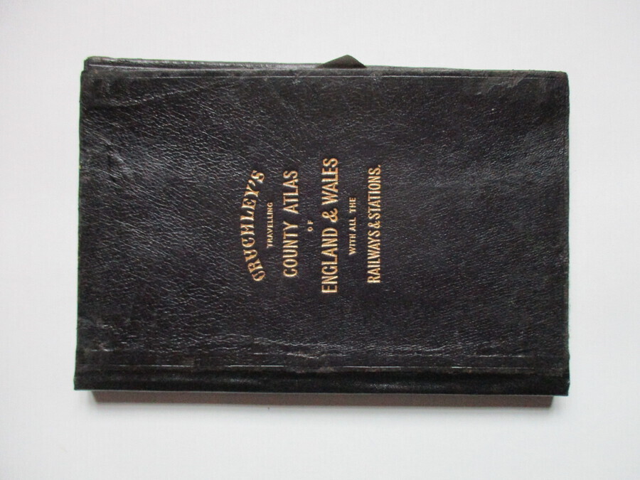
Cruchley’s County Atlas of England and Wales shewing all the Railways & Stations with their names, also the turnpike roads and principal crossroads to all the cities and market towns with distance from town to...
£425.00
view detailsarthur hook, bristol, united kingdom
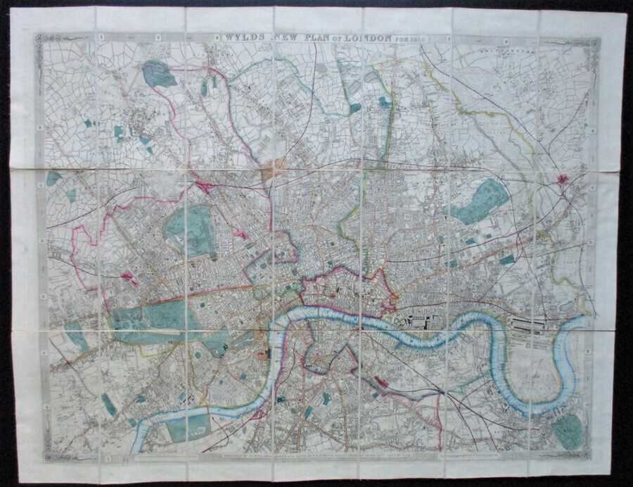
Wyld’s New Plan for London for 1859. Published by James Wyld, Geographer to the Queen and Prince Albert, January 3rd 1859. In 21 sections. Size 80 by 62.5 cm. Scale three inches to the mile....
£400.00
view detailsgerald mathias fine antique boxes, chiswick, united kingdom
W. THORNHILL & CO., 144 NEW BOND STREET, LONDON. An Oak latched Drop Front Cabinet, the engraved brass strip above engraved with the titles of the five reference directories comprising Army List, Postal Guide, Whitaker's...
£850.00
view detailsjames gauld, killin, united kingdom
This is an excellent book on the Grampian Mountains as sketched by the author and then etched by Henry Morton to form the book. The book is in excellent condition, the book has not been...
£600.00
view details99 curiosities international ltd, plummers plain, united kingdom
This is a lovely French Book on Napoleon printed one 1936. It is in fair condition as can be seen from the pictures and is a lovely item.
£55.00
view detailsmitch, fresh meadows, united states
France Early 1912/1913 88 x 62 cm Le Petit Journal was a conservative daily Parisian newspaper published from 1863 to 1944. It was one of the four major French dailies. In 1890, its circulation first reached one million...
£310.66
view detailsprivate seller, mirfield, united kingdom
1904-1920 Bartholomew’s “Half-Inch to Mile” map of England & Wales. (Cover title: Bartholomew’s new Reduced Survey for Tourists & Cyclists.) In 37 sheets. [Distinction between first class and secondary roads (in red) for the first...
£500.00
view detailsprivate seller, colombo, sri lanka
The Art Journal 1983 by Edward Burne Jones
PLEASE ENQUIRE
view detailsjohn bryant-pictures and prints, spalding, united kingdom
Antique Map of Lincolnshire 14 1/4" H X 16 1/2" W. Original print with Cartouche & glazed with Hogarth frame. Not for use as guidance for motoring but otherwise nice condition!
PLEASE ENQUIRE
view detailsjohn bryant-pictures and prints, spalding, united kingdom
Antique map of Darbyshire (sic) 14 1/2" H X 16 1/2" W. Sold by Abei Swale Awnsham & John Churchill. Framed & Glazed and in good order. Original Print with Cartouche.
PLEASE ENQUIRE
view detailsmaltese antiquarian, siggiewi, malta
Period / date: 1626 - 1627 Condition : Good Measurements : 17.5 by 24 cm. Description : Copper engraving, fine map showing a panoramic view of Malta and illustrating the main fortified cities with Valletta...
PLEASE ENQUIRE
view detailsmaltese antiquarian, siggiewi, malta
Period / date : c1702 - 1724 Measurements: Image measures 57.5 by 48 cm. Condition : Very good Description: Copper engraving depicting or showing a map of Malta and the Maltese islands entitled Insularum Maltae...
PLEASE ENQUIRE
view details