featured item

folding map of london & it's environs jan 1st 1840

antiques available from other sellers in antiques interior design modern and vintage > other interior design
-
![Portrait of a member of the Luttrell Family]() £2800
£2800portrait of a member of the luttrell family Read more
Artware Ltd -
![Rare vintage HERMES fur blanket]() POA
POArare vintage hermes fur blanket Read more
Private seller -
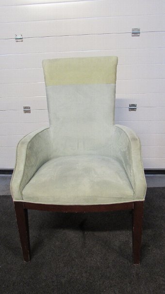
![Suede desk chairs two-tone green]() £120
£120suede desk chairs two-tone green Read more
SER Logistics -
![Still life of fruit with a field mouse in the foreground]() £1500
£1500still life of fruit with a field mouse in the foreground Read more
Artware Ltd


- View other items in:
- antiques interior design modern and vintage
- other interior design
Still not found something similar? Why not save a search and get a notification in your inbox when an matching antique is added to our ever-growing database?
Enter your email address to be sent alerts when new items are added to the site that match your search criteria

This is a folding map of London & it''s Environs, drawn and engraved for the Lewis Topgraphical Dictionary and first published on 1st January 1840. It is certain to be a talking point in your home, or wherever you choose to display it.Folding maps were practical items for use on the open road in ancient times. With the development of the roads and canals in Britain people relied on improved surveying techniques that in turn this led to more accurate maps. The size and the rapid expansion of London and other cities meant that good maps were essential to anyone wishing to travel around the city and beyond without getting lost.As the number of travellers grew so did the demand for maps, which had to be large enough to read but small enough to carry around. They had to be robust, a purely paper map would soon disintegrate with constant opening and closing. The solution was to dissect the map and lay it down on linen or calico, which greatly extended the map''s life.The map is very detailed, and shows a plan of London at street name level as it was in 1840. MeasurementsThe map measures 98 cm high and 118 cm wide.ConditionThis map is in excellent condition. Please see photos for confirmation of its condition.
Antiques.co.uk Ref: 4BW2GJP4
Here on antiques co uk we love antiques and specialise in selling antiques. Even though this item was for sale and is now sold or otherwise now unavailable we have many more items for sale including vintage antiques, silver, tables, watches, jewellery and much more for your interiors and home.
Search all the antiques currently for sale on www.antiques co uk. Or why not consider selling your antiques and making sales more easily with us!