


bridge at la schieggia in the apenninci on the via flaminia, italy, built 1805
- View other items in:
- antiques interior design modern and vintage
- other interior design

artware ltd
Enquire about this antique
Artware Ltd has 565 antiques for sale.
click here to see them all

inscribed " The Cylindrical perforation is 65 ft in diameter. / Depth from the foot of the parapet to the bottom of the Ravine is 230 English feet
Scheggia and Pascelupo are two separate towns in northeastern Umbria about 15 km apart, that share the official honor of being the seats of the comune. The real power in the comune is Scheggia, since Pascelupo is in fact the merest hamlet in one of the remotest mountainous areas of the region, a few hundred meters from the border of the Marche, linked to the outside world by a gravel road.
Scheggia, the ancient Roman town of Schisa, is 12 km S of Cantiano (in the Marche) and 7 km N of Costacciaro on the Via Flaminia, still a major highway 22 centuries after it was first built, where it intersects an important road out of Gubbio (12.5 km SW). Because of this, the town appears to be having a population boom: certainly there is construction all over the place.
The most interesting and beautiful sight, however, in the territory of the comune is probably the 11c abbey of S. Emiliano in Congiuntoli, about 10 km E of Scheggia. The Via Flaminia was a Roman road leading from Rome to Ariminum (Rimini), and was the most important route to the north. It was constructed by Flaminius during his censorship (220 BC). We hear of frequent improvements being made to it during the imperial period. Augustus, when he instituted a general restoration of the roads of Italy, which he assigned for the purpose among various senators, reserved the Flaminia for himself, and rebuilt all the bridges except the Pons Mulvius, by which it crosses the Tiber, 3 km (2 mi) north of Rome (built by Marcus Aemilius Scaurus in 109 BC), and an unknown Pons Minucius. Triumphal arches were erected in his honour on the former bridge and at Ariminum, the latter of which is still preserved. Vespasian constructed a new tunnel through the pass of Intercisa (Furlo), in 77, and Trajan, as inscriptions show, repaired several bridges along the road.
In the Middle Ages it was known as the Ravenna road, as it led to the then more important city of Ravenna. Following the end of the Exarchate of Ravenna, it fell into disuse during the Lombard period, but was partially reconstructed in the Renaissance era and continued to be of military importance down to the Napoleonic era and World War II. As the SS 3 (Strada Statale 3) it remains one of the principal highways from Rome to the Adriatic.
The importance of the ancient Via Flaminia is twofold: during the period of Roman expansion in the 3rd century BC and 2nd century BC, the Flaminia became, with the cheaper sea route, a main axis of transportation by which wheat from the Po valley supplied Rome and central Italy; during the period of Roman decline, the Flaminia was the main road leading into the heartland of Italy: it was taken by Julius Caesar at the beginning of the civil war, but also by various barbarian hordes, Byzantine generals, etc. A number of major battles were therefore fought on or near the Via Flaminia, for example at Sentinum (near the modern Sassoferrato) and near Tadinum (the modern Gualdo Tadino). In the early Middle Ages, the road, controlled by the Eastern Empire, was a civilizing influence, and accounted for much of what historians call the "Byzantine corridor". The Via Flaminia starts at Porta del Popolo in the Aurelian Walls of Rome: Via del Corso (Via Lata), which connects the Campidoglio to the gate, can be considered the urban stretch of the Via Flaminia. Then road then runs due north, considerable remains of its pavement being extant under the modern road, passing slightly east of the site of the Etruscan Falerii (Civita Castellana), crossing the Tiber into Umbria over a bridge some slight vestiges of which can still be seen, the "Pile d'' Augusto". From there it made its way to Ocriculum (Otricoli) and Narnia (Narni), where it crossed the Nera River by the largest Roman bridge ever built, a splendid four-arched structure to which Martial alludes[1], one arch of which and all the piers are still standing; and went on, followed at first by the modern road to Casuentum (San Gemini) which passes over two finely preserved ancient bridges, through Carsulae to Mevania (Bevagna), and thence to Forum Flaminii (S. Giovanni Profiamma). Later, a more circuitous route from Narnia to Forum Flaminii was adopted, increasing the distance by 12 Roman miles (18 km) and passing by Interamna Nahars (Terni), Spoletium (Spoleto) and Fulginium (Foligno) ? from which a branch diverged to Perusia (Perugia).
From Forum Flaminii the Flaminia went on to Nuceria Camellaria (Nocera Umbra) ? whence a branch road ran to Septempeda and thence either to Ancona or to Tolentinum (Tolentino) and Urbs Salvia (Urbisaglia) ? and Helvillum (site uncertain, probably Sigillo, but maybe Fossato di Vico), to cross the main ridge of the Apennines, a temple of Jupiter Apenninus standing at or near the summit of the pass according to one ancient author. From there it descended to Cales (Cagli), where it turned north-east following the gorges of the Burano River.
The narrowest pass was crossed by means of a tunnel chiseled out of solid rock: a first tunnel apparently of the 3rd century BC was replaced by an adjacent tunnel by Vespasian. This is the modern Gola del Furlo, the ancient name of which, Intercisa, means "cut through" with reference to these tunnels. The modern 2-lane road, the SS 3 Flaminia, still uses Vespasian''s tunnel, the emperor''s dedicatory inscription still in place; remnants of the earlier tunnel can also be seen.
The Flaminia emerged from the gorges of the Apennines at Forum Sempronii (Fossombrone) and reached the coast of the Adriatic at Fanum Fortunae (Fano). Thence, it ran north-west through Pisaurum (Pesaro) to Ariminum (Rimini). The total distance from Rome was 210 Roman miles (311 km) by the older road and 222 (329 km) by the newer. The road gave its name to a juridical district of Italy from the second century onwards, the former territory of the Senones, which was at first associated with Umbria (with which indeed under Augustus it had formed the sixth region of Italy called Umbria et Ager Gallicus), but which after Constantine was always administered with Picenum.
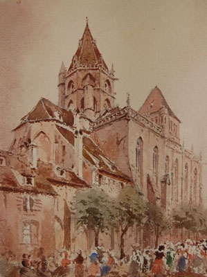
Antiques.co.uk Ref: 3VQVN637
- Materials:
- Watercolour
- Width (cm):
- 22.86 x 15.24 cm 9.00 x 6.00 ins
Artware Ltd
Artware Fine Art specialises in fine antique, decorative and historical portraits and topographical pictures . We cover a period from the 17th and 18th centuries through to the 19th & 20th Centuries. We have over 150 portraits in stock, which can be viewed on our web site, each historical portrait has well researched biographical information both on the sitter and the artist.
Contact details
18 La gare
51 Surrey row
London
Greater London
SE1 0BZ
UNITED KINGDOM
T: 0207 921 97904
E: greg@artwarefineart.com
W: www.artwarefineart.com
Other antiques available from artware ltd